How to find ridges from a drainage direction map in GRASS GIS
Sometimes, we need to figure out where rain drops start flowing (i.e., ridges, hilltops, or headwaters with no contributing upstream cells) from a drainage direction map (drain_dir) only.
r.mapcalc expression='ridges=if(drain_dir[-1,-1]!=7 && drain_dir[-1,0]!=6 && drain_dir[-1,1]!=5 && drain_dir[0,1]!=4 &&'\
' drain_dir[1,1]!=3 && drain_dir[1,0]!=2 && drain_dir[1,-1]!=1 && drain_dir[0,-1]!=8, 1, null())'
If we have a flow accumulation map (flow_accum) that was generated using a single flow direction algorithm, the following command will generate the same output because ridge cells always get assigned 1 (itself) as the number of contributing cells.
r.mapcalc expression='ridges=if(flow_accum==1, 1, null())'However, when we use a multiple flow direction algorithm, there is no guarantee that ridge cells will get assign 1 because there can be partial flows from neighbor cells. In this case, the first method may be useful.
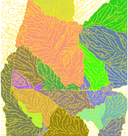
Figure 1 shows ridge cells in yellow and sub-watershed polygons in the background.

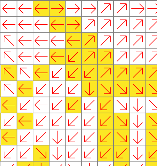
Figure 2 clearly shows that these ridge cells do not have any contributing upstream cells.

